

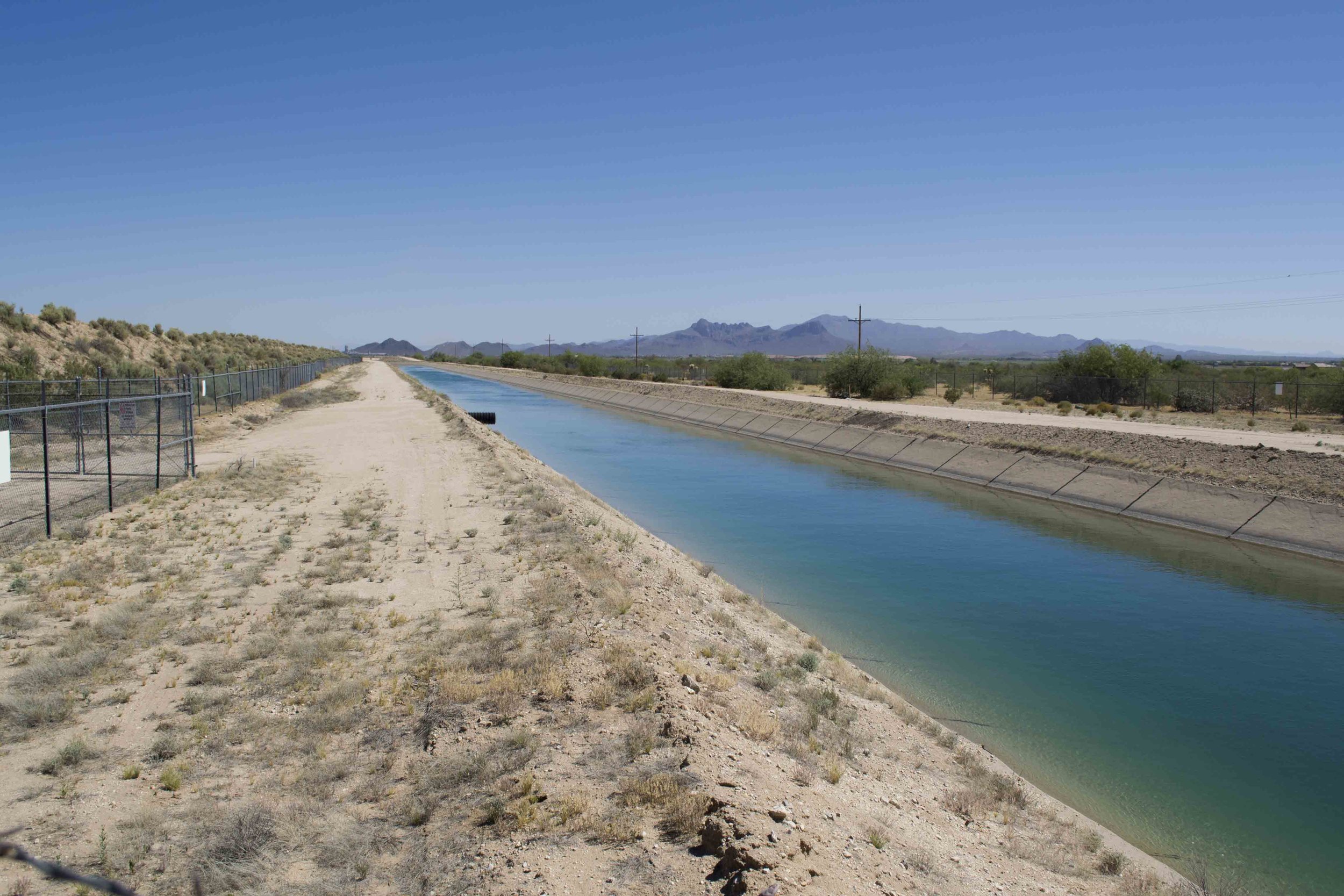
Central Arizona Project Canal as it runs near San Lucas in North Marana
Over the next several months, the Town of Marana and Pima County will work together to plan, design, and construct a trail that parallels the Central Arizona Project (CAP) within the town limits. On May 2, the Marana Town Council passed a resolution accepting an intergovernmental agreement with Pima County that formalizes this partnership. While this project does not yet have a definite timeline, Town and County officials expect it to be opened in 2018.
This segment in Marana is part of a longer trail route that follows the CAP canal along its entire length of 336 miles. In June 2003, this pathway was designated as a National Recreation Trail. Once completed, this trail will become the second National Recreation Trail within Town limits, after the Wild Burro Trail in the Tortolita Mountains.
The CAP canal stands as one of the foremost engineering achievements in Arizona, alongside structures like the Hoover and Glen Canyon Dams. Construction began in 1973 and after 20 years, the project was completed in 1993. As a result of this massive undertaking, Arizona cities along its course, like Marana, can now rely on a steady supply of water from Lake Havasu.
Future route of CAP Trail
The primary access point for the trail will lie just north of Tangerine Road and east of I-10, where the CAP canal briefly dips underground to flow under the freeway. Currently, grazing cattle occupy the land surrounding this location. The Town and the County are currently working to provide access off Tangerine Road to the trailhead. From there, the trail will travel northwest alongside the canal. A substantial earthen berm will provide the primary surface. This terrain feature helps protect the CAP from run-off from the Tortolitas during heavy rains. Now, it will add a new purpose to its repertoire.
“This is the kind of project that really makes sense on several levels,” says Recreation Coordinator Bob Stinson. “Because of the berm, there’s basically already a trail adjacent to the canal, so really we’re just working with all the appropriate jurisdictions and landowners to open that trail to the public.”
When open, the trail will offer a 6.7-mile shared-use path stretching from Tangerine Road to the northern Marana Town limit, at which point Pinal County will open their stretch of the CAP Trail. While motorized vehicles will be prohibited from using this amenity, cyclists, walkers, joggers, and hikers can all enjoy unfettered access. Additionally, due to the location atop the berm, the entire trail will offer sweeping views of the Tortolita alluvial fan. For the safety of users and the security of the canal, a tall fence will continue to stand between the trail and the CAP.
“We have an incredible network of trails throughout the community,” says Parks and Recreation Director Cynthia Nemeth-Briehn. “From the mountainous trails in the Tortolitas to the paved shared-use path that connects to the Loop system, Marana residents have a wealth of outdoor recreation options. We’re very excited to add this new trail to these offerings.”

Crested Saguaro in the Tortolita Mountains
While the trail may not be ready until mid-2018, that should not stop future users from taking advantage of other hiking opportunities in this area. The Tortolita Preserve features some of the largest saguaros in the entire region, and the Wild Burro Trail whisks visitors up into the rugged Tortolita Mountains, featuring an unusual density of crested saguaros. There are already a variety of ways to enjoy Marana’s Sonoran Desert beauty, and in the not-too-distant future, there will be one more.
